Forecasters declare a First Alert Weather Day as midday sunshine destabilizes the atmosphere ahead of an approaching cold front, followed by blustery weekend wind chills in the 30s
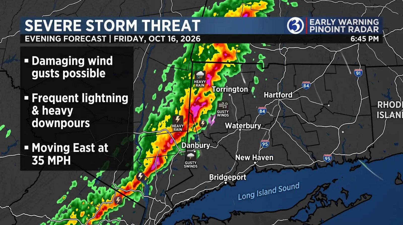
HARTFORD, Conn. - Broadcast meteorologists across southern New England declared a First Alert Weather Day for Friday as an approaching cold front heightened the Connecticut severe storm threat for the evening commute and overnight hours. After scattered morning showers give way to breaks of afternoon sunshine, forecasters warn that a line of strong thunderstorms could generate isolated damaging wind gusts up to 60 mph after sunset.
The unsettled weather pattern unfolds in two distinct phases across the state. Light rain showers arrived near daybreak Friday, accompanied by patchy morning fog that reduced visibility along major commuter corridors prior to noon. According to forecast discussions from WFSB and WTNH, that initial wave of moisture is expected to exit by early afternoon, yielding a multi-hour dry lull punctuated by periods of sunshine.
Any afternoon clearing will play a pivotal role in destabilizing the lower atmosphere. Southerly and southwesterly breezes between 8 and 13 mph, with background gusts reaching 24 mph, will pump milder air northward across the region. Daytime high temperatures are projected to climb to around 70 degrees in Hartford and northern counties, while reaching 71 degrees along the Interstate 95 shoreline. That unseasonable warmth will provide extra thermodynamic energy as a sharp cold front advances eastward from New York during the evening.
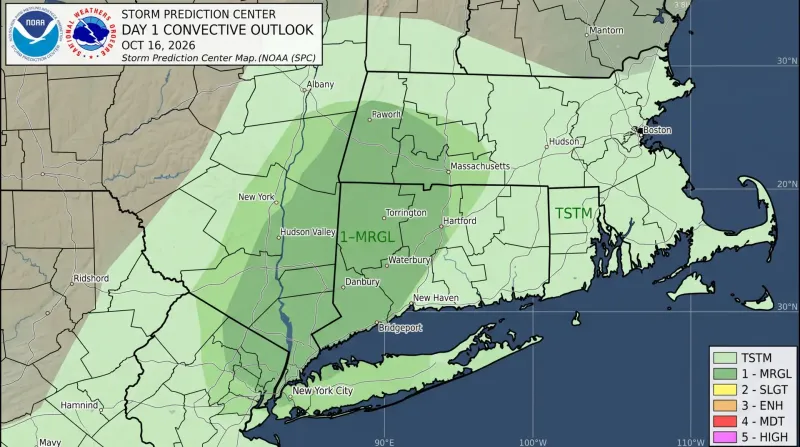
The federal Storm Prediction Center placed western Connecticut under a Level 1 marginal risk for severe weather, signaling the potential for brief, isolated severe thunderstorms embedded within the frontal squall line. Forecasters at WFSB issued their First Alert Weather Day designation specifically to highlight the evening window, when high-school football games and outdoor autumn events could face sudden disruptions from lightning and downpours.
While widespread tornado activity or destructive hail is not anticipated, WTNH meteorologists emphasized that the primary hazard from any robust storm cell that develops would be a localized straight-line wind gust reaching up to 60 mph. Winds of that velocity can snap tree limbs still carrying autumn foliage and trigger scattered power outages across wooded residential neighborhoods.
The National Weather Service projects an 80 percent likelihood of precipitation across northern Connecticut and a 70 percent chance across southern coastal communities after 5:00 p.m. Friday. Showers and embedded thunderstorms are expected to persist through midnight before tapering off between 1:00 a.m. and 3:00 a.m. Saturday. Standard basin-wide rainfall totals are forecast to range between one-tenth and one-quarter of an inch, though localized downpours inside heavier thunderstorm cores could produce higher amounts.
Once the cold front clears the eastern seaboard early Saturday morning, brisk northwest winds will usher an abrupt autumn chill across Connecticut. Overnight temperatures Friday will tumble to around 49 degrees inland and 43 degrees near the coast, setting the stage for a raw and blustery Saturday afternoon where daytime highs struggle to reach 53 to 54 degrees.

Sustained northwest winds of 15 to 18 mph, paired with frequent gusts between 30 and 40 mph, will make Saturday afternoon feel like the mid-30s and low 40s across much of the state, prompting meteorologists to advise residents heading outdoors to bundle up in layers. WTNH forecasters noted that cold air wrapping behind the departing system could even squeeze out the season first snow flurries across the higher terrain of the Northwest Hills in Litchfield County. Even so, WFSB meteorologists dropped an earlier weekend alert flag after computer models indicated the Saturday wind and cold would fall short of hazardous criteria.
Skies will clear rapidly Saturday evening as winds diminish, allowing radiational cooling to pull overnight lows down to the 32-degree freezing mark across inland valleys and 36 degrees along the Long Island Sound shoreline. Tranquil high pressure will then dominate Sunday and Monday, delivering abundant sunshine as afternoon highs recover from the mid-50s Sunday into the low 60s by Monday afternoon.
WFSB Channel 3 Eyewitness News


Comments
No comments yet — be the first.
Leave a comment